
Reading the Sky: A Survivalist’s Guide to Predicting Weather from Clouds

Written by: Keyara Nelson
Thumbnail and Banner Photo by: Tom Barrett on Unsplash
One day, while hiking through the remote wilderness of Northern Ontario, I came across another hiker. Despite the warm summer air, he wore a rain jacket. When I asked why, he smiled and said a storm was coming. Only a short while later, the first raindrops began to fall; his secret, he told me, was simple — “just read the clouds.”
Long before satellites and phone apps, survivalists read their forecasts through the language of clouds. It is an ancient skill, one that connected people to the Earth long before science gave names to cirrus or cumulonimbus. For sailors, farmers, and wanderers, the sky was both map and messenger, a living canvas that revealed what was coming hours or even days ahead. This practice can still be applied today, all one has to do is look up. Whether you’re a budding nephologist or just curious reader, this guide will provide you with the basics of understanding the language of clouds.
To begin, I want to emphasize the importance of geographic location when predicting weather. Different regions of the world have different cloud phenomena, and therefore, may have different forecasting predictions while observing clouds. This guide is for North America, though some of the basics apply elsewhere as well. To forecast the weather by observing clouds, the focus is on visible patterns such as their size, shape, altitude, vertical development, and the subtle variations in their color and shading. One of the biggest things to know are the varying levels of clouds in the troposphere (which is the lowest level of the Earth’s atmosphere); the three levels of clouds in the troposphere are high, middle, and low.
High clouds often begin with the prefix “cirro” ; they are above 20,000 feet. The three basic cirro clouds are:
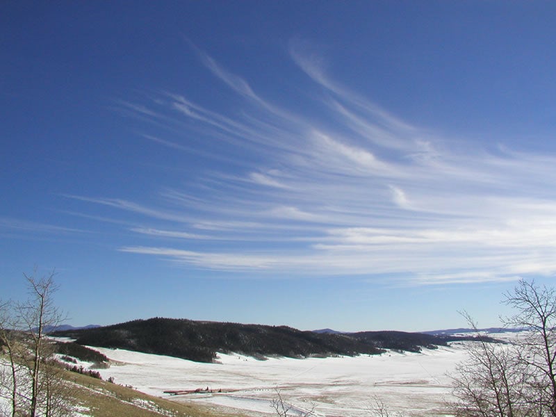
Cirrus: appear similar to long, thin, wispy streamers that are high in the sky, they are often seen during fair weather but can be an indication for more troublesome things to come. Cirrus clouds are often the forerunner of approaching bad/unsettled weather, with the potential for wind and precipitation in the next 24 hours.
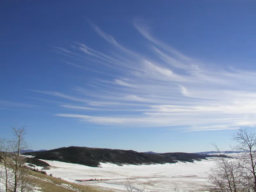
Photo by Lisa Gardiner on UCAR
Cirrostratus: are characterized by their thin, sheet-like appearance high up in the sky; they usually cover the entire sky! These clouds are indicative of rain or a snow storm - relatively quickly as well - expect to see precipitation within 12 to 24 hours.

Photo by Anne Pharamond on UCAR
Cirrocumulous: these clouds are quite common in cold weather, and are characterized as thin, rounded puffs. They are often indicative of fair, cold weather, though in the tropics they can have hurricane potential!

Photo by UCAR on UCAR
Mid-level clouds often begin with the prefix “alto” ; they are between 6,500 and 20,000 feet. The two basic alto clouds are:
Altocumulus: appear as white or gray patches, often forming in layers or waves that resemble a field of cotton balls. They have rounded shapes but can also appear as ripples. These clouds are often associated with fair and pleasant weather, but on a warm, humid morning there could be a thunderstorm by afternoon.

Photo by Nichalp on Wikipedia
Altostratus: appear as smooth, gray or blue-gray sheets that often cover the entire sky. Unlike cirrostratus, they block out most of the sun, creating a dull, muted light. Altostratus clouds are usually a sign that a warm front is approaching; expect continuous rain or snow to follow within 12 to 24 hours.

Photo by Keith G. Diem on UCAR
Finally, low clouds do not have a designated prefix, but their names are derived from “strato” or “cumulo” depending on their characteristics; they are below 6,500 feet. These clouds are most familiar to us and are associated with fog, drizzle, and storms — the kinds that directly affect conditions on the ground. These clouds are known as:
Stratus: are low, uniformly grey-white, appear like a sheet and often cover the entire sky. They often bring overcast days with light mist or drizzle. In hilly or coastal regions, they can appear as fog when they touch the ground.
Photo by Sara Martin on UCAR
Stratocumulus: resemble a lumpy, low-level blanket of gray and white, often appearing after rain has passed. While they rarely produce heavy precipitation, they can bring light rain or drizzle. A clearing stratocumulus layer can indicate improving weather conditions. One thing to note, to distinguish altocumulus and stratocumulus, point your hand toward the cloud. If the cloud is about the size of your fist, then it is stratocumulus.

Photo by What’sThisCloud
Nimbostratus: thick, dark, and sprawling across the sky, these clouds are the classic rain-makers. Nimbostratus clouds form during slow-moving fronts and bring steady, prolonged rain or snow. Once you see these clouds, precipitation is either happening or imminent.
Photo by Peggy Lemone on UCAR
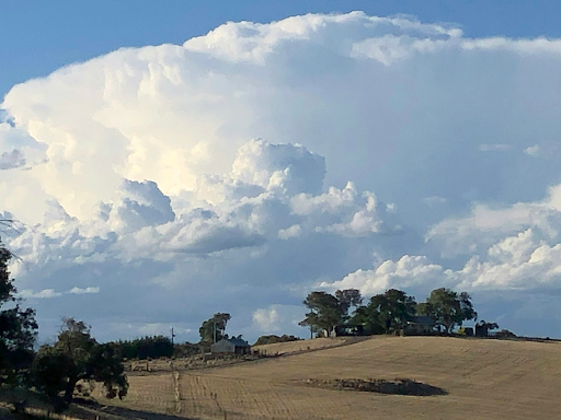
The most frightening cloud to see, in terms of common clouds, would most likely be the Cumulonimbus: these are the giants of the cloud world, and can grow to heights of up to 10 km high. Their massive, anvil-shaped tops often signal violent weather such as thunderstorms, lightning, hail, or even tornadoes. These clouds don’t just warn of danger — they carry it within them.
Photo by Neroli Wesley on Unsplash
The key to reading clouds isn’t just knowing what they look like — it’s recognizing how they change. A single formation can transform within minutes, offering early signs of shifts in air pressure, humidity, and wind direction. A clear morning with cirrus clouds can give way to altostratus by noon and nimbostratus by evening. That progression tells you a story: a storm front is moving in.
When you’re in the wilderness, that awareness can mean the difference between a dry campsite and being caught in a downpour. The more time you spend watching the sky, the more intuitive this skill becomes. Eventually, you’ll start to sense the weather before it arrives, all you have to do is look up and learn their language.